A wadi is an Arabic word for a valley or water channel. It is an ephemeral watercourse in arid regions transecting from mountains and foothills pushing water through channels to the lowest points that defines the catchment. It plays a most significant role in formation and occurrence of rainfall, and groundwater reservoir that are replenished through infiltration. They are a vital water source for Jordan leading the water into the Jordan Rift Valley.
Migratory changes have caused a large influx of population into Amman, the largest city in Jordan, from 1994 onward leading to a geographic expansion of the city. This rapid urbanization, population growth and concretization of the wadi system have posed challenges to the efficient utilization of the renewable source of water harnessed from the wadi itself.
Thus wadi [re]urbanization redefines new patterns of urbanization driven by logics of water instead of economic drivers. It uses systems of water retention and collection through ancient water harvesting techniques that rely on earthwork techniques that depend on the existing topography of the wadi.
Regional Scale
Site
Cities and even future development proposals in Jordan depend on highways and roads that dictate city growth and urban pattern. Wadi urbanization concretizes its surface through this highway. For the proposal look at town Rashidiyah situated near Aqaba in Wadi Yutum as a prototype for the potential and possibility of Wadi [Re]urbanization. The town of Rashidiyah is located north to the entrance gate of Wadi Rum, a tourist national park. The approximate area of town is 1 sq km housing 3424 people. The water is supplied from disi aquifer to a distant location that is then transferred through trucks. Historically town of Rashidiyah was a temporary settlement, occupied by a nomadic Bedouin community. Later after the construction of houses by the King of Jordan, a new migrant farmers community occupied the to finding work in the nearby large scale graze farmlands. The dead sea highway runs along the town, cuts across the existing wadi flow. Hence, our project aims to address existing farmlands and tourism activity in order to be integrated with our wadi development project.
SYSTEM
Our prototype proposes a water based density of 1,453 people per sq.km.
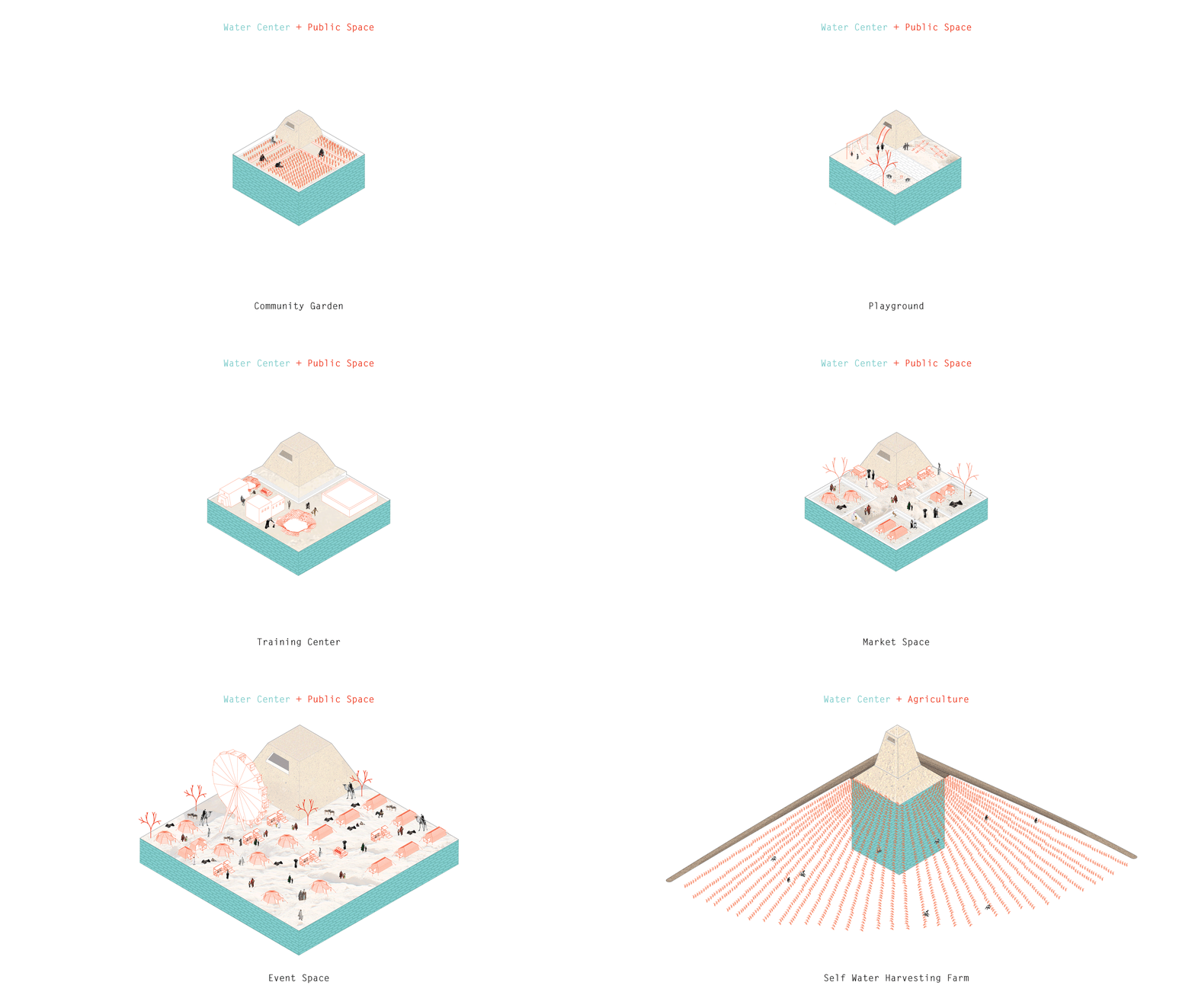
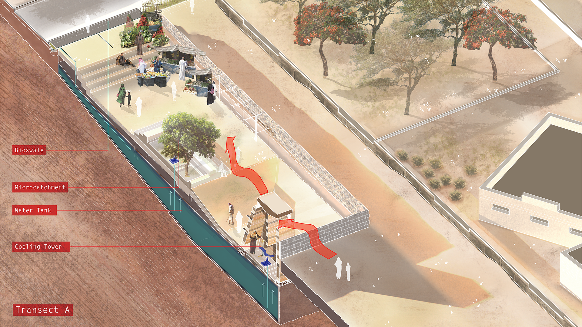
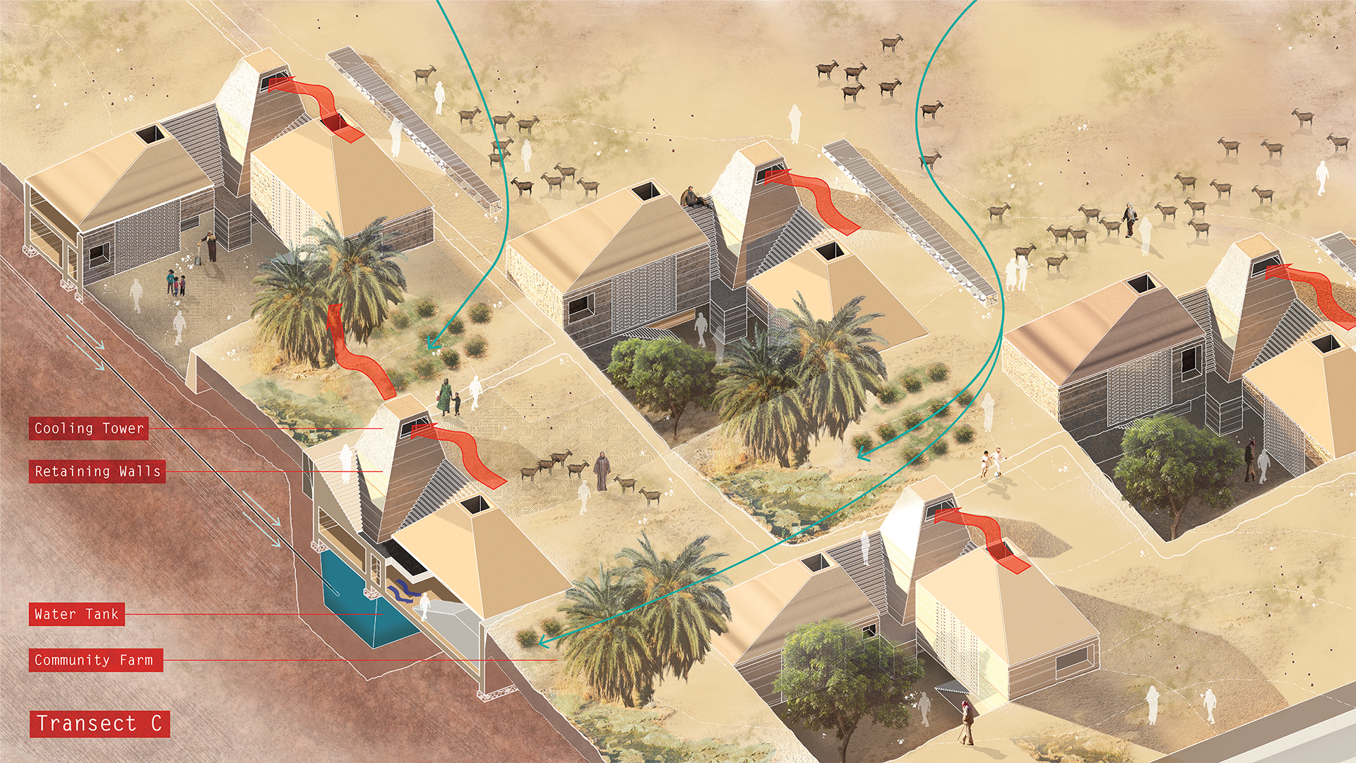
The proposal integrates micro catchment, rammed earth construction technique and bioswales to create a module for water retention, collection and distribution system. A micro catchment is a specially contoured area with slopes and berms designed to increase runoff from rain and concentrate it in a planting basin where it infiltrates and is effectively “stored” in the soil profile. The water is available to plants but protected from evaporation. They are simple and inexpensive to construct and can be built rapidly using local materials and manpower. The micro catchment are attached with a water core using construction material obtained from earth to collect rainwater. The core acts as Persian wind catcher to control micro climate in a desert region.The entire system attached to the bioswale creates an integrated water cycle system.This module/system can be integrated with public space, community living, and new form of agriculture in varied scales.
DESIGN RATIONALE
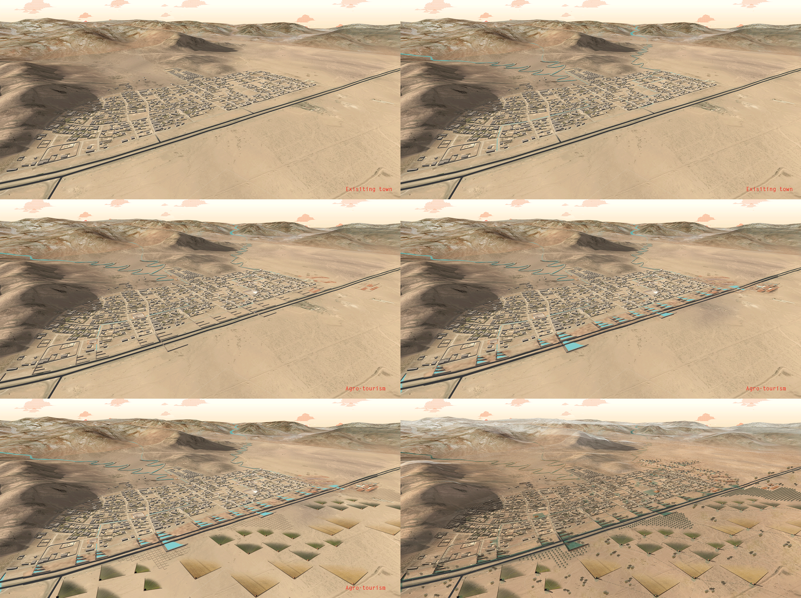
The existing water and wadi flows were identified by finding the lowest points along the topography. The land form of this highland of the surrounding mountains of the town is manipulated through earthworks to retain water. Catchment areas are clearly defined for the purpose of capturing water for the existing town. This water is dispersed through water channels and bioswales along the existing street network to water centers in the lower level to reintroduce and imitate natural water flow.
New farm typology, including olive farm, crop field and gazing, are fed by treated grey water from households in the existing towns through natural filtration and treatment ponds along the highway. New farming typology is created to maximize growth through irrigation from this treated grey water to create a new urban network for tourism economy. The lodging and market area along the highway are ancillary building to accommodate the growing tourism. New housing on the north side of the existing town are formed within this water holding landscape. The density is dictated by the capacity of the delineated catchment area that is behind the new housing.
Therefore the proposal transect through 3 sections of the site addressing specific site conditions and speculating their future growth pattern.
PHASING
Transect A - Existing town
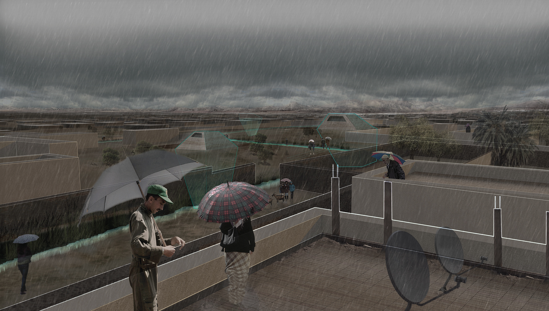
In the existing city grid, the water collected from the catchment area behind the town is distributed through bioswales feeding into the existing town fabric. The vacant lots in the city grid are converted into points of collective water centers. These water center transforms into new social space varying in scales and functions for the community. They accommodate programs like markets, playgrounds or a training center in order to learn how to deploy these earthwork techniques. In essence, the existing city of Rashidiyah becomes a reservoir. When it rain, these water centers or underground reservoirs, become activated, storing water for the future of the town. The water centers in the existing town perform as a decentralized water distribution network. The water center creates a platform for learning,economic activity and a new way of living. The water center are a new infrastructural system deployed to existing fabric that will revive the wadi as a resource
Transect B - Agro Tourism
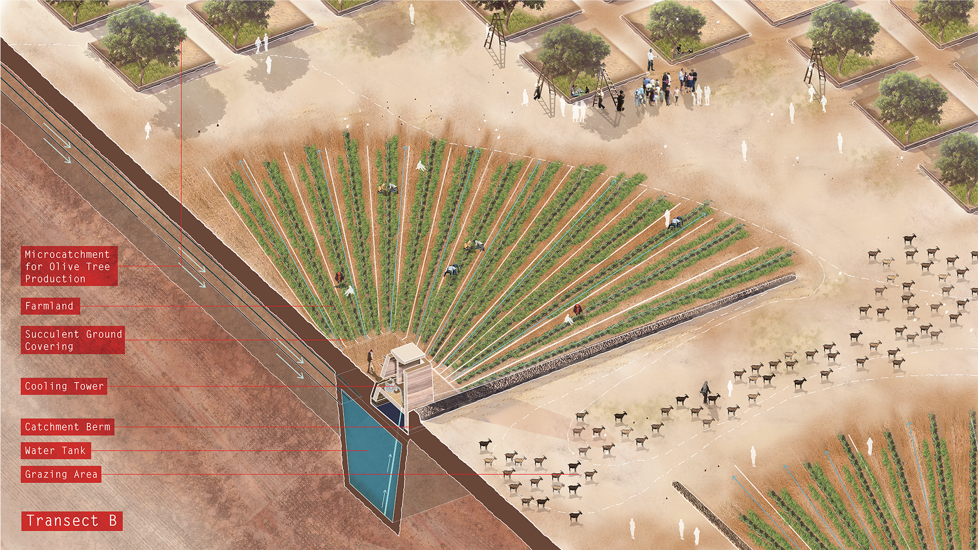
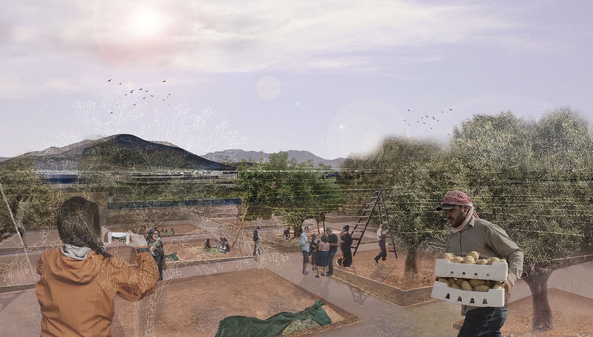
Finally, zooming into the intersection of the existing town, the highway and the land adjacent to the highway, this area provides an opportunity to promote an Agro Tourism based on tourists taking part in agriculture production, such as olive oil production and processing, which is a growing enterprise in Jordan The buffer alongside the highway, serviced through a combination of stone, gravel, and sand filters takes the grey water from the existing town and pipes it into the new agriculture patterns.
The Agro Tourism is a growing enterprise in Jordan, It will not only be a tourist place for stay and visit but will also generates long term economic benefits from olive oil production and processing. It will be a new destination for the tourist visiting Wadi Rum. The harvest season will be a addition to the incoming tourist flux. The field of agriculture patterns are transcribed based on how much water each crop needs, with the crops needing the most amount of water, such as cabbage, planted closer to the filtration ponds. Olive harvesting as part of this Agro Tourism takes place from November onward offsetting the tourist season of the adjacent Wadi Rum in early spring and fall.
Transect C - New Town
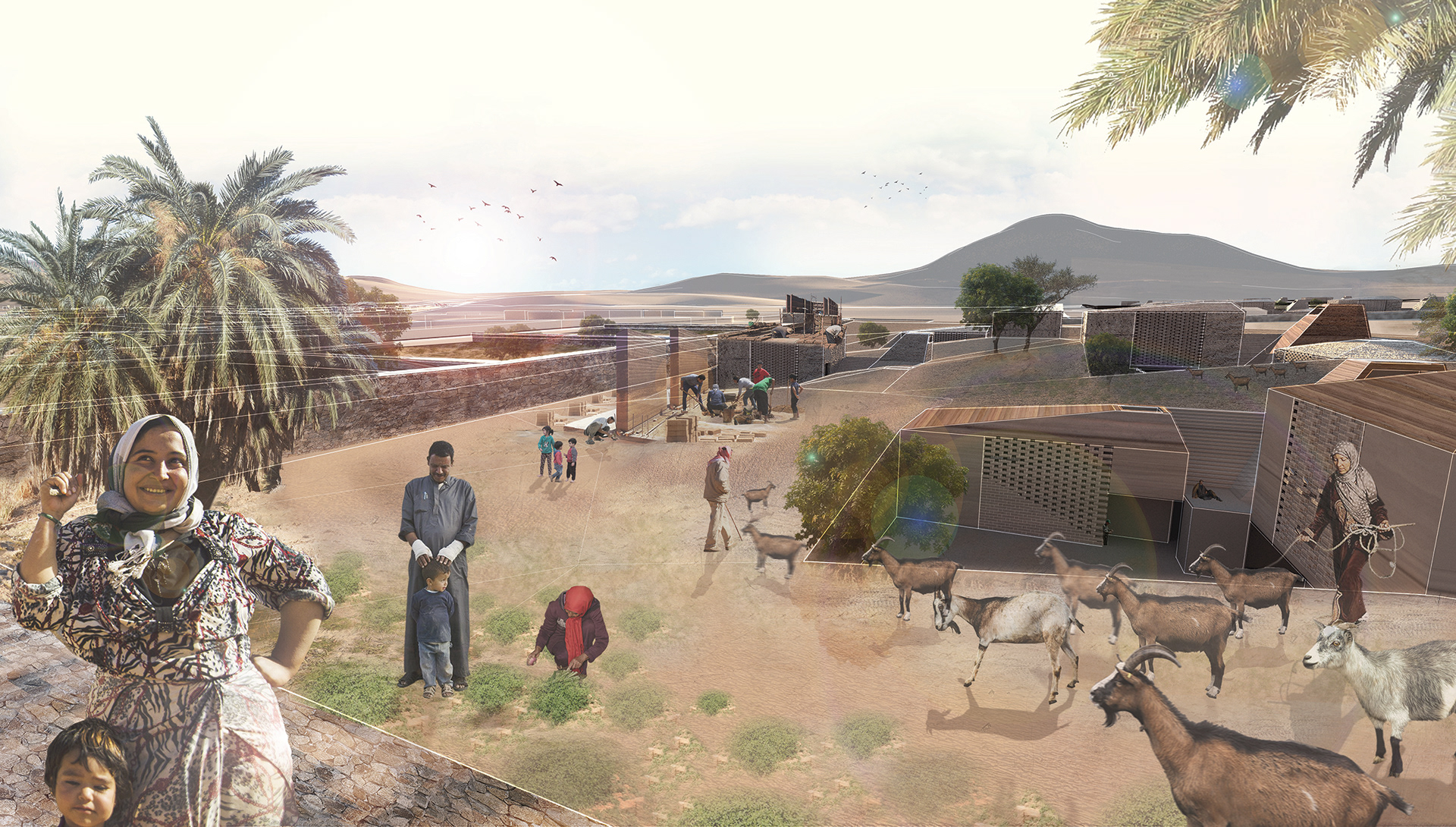
The north side of the town is envisioned to accommodate a growing population. The ground is prepared before in order to provide areas for holding and catching the water. The manipulation of the earth is to provide pockets for housing that integrates the logic of water flow through the use of gabion diversion walls and water core. The new housing typology sits within the ground itself providing the benefit of passive cooling through the earth itself. Water is also diverted into the new housing cluster through its proximate water catchment area and water center. The integrated water core also serve as a wind tower, modeled after ancient Persian wind catchers that uses the coolness of the underground water to chill the housing unit. These new housing typologies, are also constructed through the sustainable technique of rammed earth construction. These techniques can be taught to the local residents themselves so that the process can be created.
Wadi [re]urbanization is an infrastructural system that can propose urban patterns that work with and grow alongside the existing wadi.It is an experiment in understanding alternative ways in which urban and cities can grow and change. Hence on a larger scale wadi [re]urbanization is a means to reduce pressure on dense urban areas of Amman and Aqaba through re-imagined areas along the wadis as places for growth and integrated development.
